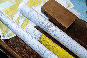
The Earth is fascinating and studying its numerous components has intrigued humankind for years. This course probes into the Earth’s shape and its nautical charts. We introduce Aristotle and Pythagoras, who first made propositions regarding the Earth’s shape. We explain how we can draw a great circle on the surface of a sphere and how the spherical triangle can be formed on the globe by arcs of three great circles. Review the concept of the Earth axis and how the polar axis connects the poles of a body. Discuss how the Earth’s axis connects the North and South Poles and how the Earth’s equator surface is equidistant from the true north and south poles. The course will also explain the shape of the planet, the nautical charts, the concept of the knot, cable, the datum, nautical publications and how to gather this important information required during sailing. Discover the features of the terrestrial coordinates and how navigators use the nautical chart to plot courses and interpret daily operations. The greatness of the nautical charts for marine navigation, the use of the title block, datum and soundings are covered in this course.
The course then explains the prime meridian and how the anti-meridian can help form a great circle to divide the Earth into different halves. We will also demonstrate the format of expressing the longitude coordinates, the concept of the geographical, statute and the nautical mile. Explore how you can measure the southern parts of a given latitude and the difference between the two latitudes. Study the natural scale and how you can use it to determine the relationship between a given distance on the chart and the Earth. This course will teach you the symbols and abbreviations that you can use on charts and consciously avoid charted dangers during passage planning. We will explain how to group the symbols and abbreviations under the required heading, the features of the notice to mariners and the light list. You will learn about tide, current tables, the coast pilots, the important nautical publications of the United States and essential admiralty nautical publications.
Become familiar with the pole of a great circle, a small circle, how you can measure the spherical angle, as well as the properties of a spherical triangle. You will also learn how the interjection of different circles can form spherical triangles. The course will teach you how to solve equations regarding oblique spherical triangles, quadrantile spherical triangles, bi-quadrantal spherical triangles, triquadrantal spherical triangles and symmetrical triangles. Understand the difference and compare latitude and longitude and how you use the sun to determine your position here on Earth. We highlight this principle for finding latitude and longitude using the sun and show you how to measure the distance between two positions on a Mercator chart. This Earth’s shape and nautical charts course will help you improve your knowledge of the procedures for correcting charts, publications and admiralty notices to mariners. This course will be of great interest to students, researchers and anyone interested in marine navigation. So register for this course and start your next learning journey today.
What You Will Learn In This Free Course
View All Learning Outcomes View Less All Alison courses are free to enrol, study, and complete. To successfully complete this Certificate course and become an Alison Graduate, you need to achieve 80% or higher in each course assessment.
Once you have completed this Certificate course, you have the option to acquire an official Certificate, which is a great way to share your achievement with the world.
Your Alison certificate is:
- Ideal for sharing with potential employers.
- Great for your CV, professional social media profiles, and job applications.
- An indication of your commitment to continuously learn, upskill, and achieve high results.
- An incentive for you to continue empowering yourself through lifelong learning.
Alison offers 2 types of Certificate for completed Certificate courses:
- Digital Certificate: a downloadable Certificate in PDF format immediately available to you when you complete your purchase.
- Physical Certificate: a physical version of your officially branded and security-marked Certificate
All Certificate are available to purchase through the Alison Shop. For more information on purchasing Alison Certificate, please visit our FAQs. If you decide not to purchase your Alison Certificate, you can still demonstrate your achievement by sharing your Learner Record or Learner Achievement Verification, both of which are accessible from your Account Settings.


 Avg. Hours
  Contains Video
  CPD Accredited
 Total XP:
 Knowledge & Skills You Will Learn


